5-Tage-Wettervorhersage San Francisco 14-06-2026

Wettervorhersage San Francisco heute 14.06.2026: bedeckt, Temperatur von 13 °C bis 20 °C.

Niederschlagswahrscheinlichkeit 35%. Wind bis zu 5.89 m/s (Böen 7.86 m/s). Luftfeuchtigkeit 65–100%, Luftdruck 758–761 mm Hg, UV-Index bis 9.7.

Wetterwarnungen

Warnungen ausblenden
MinorJun 14, 12:54 PMJun 15, 04:00 AMMit Google übersetzen
Coastal Flood Advisory issued June 14 at 5:54AM PDT until June 17 at 3:00AM PDT by NWS San Francisco CA

Coastal Flood Advisory

* WHAT...For the Coastal Flood Advisory, up to 2.0 ft of inundation above ground level is possible in low-lying areas near shorelines and tidal waterways. For the Beach Hazards Statement, increased risk of sneaker waves and strong rip currents expected. * WHERE...Low-lying coastal and bayshore areas in San Francisco. * WHEN...For the Coastal Flood Advisory, until 3 AM PDT Wednesday. For the Beach Hazards Statement, through late Tuesday night. * IMPACTS...Flooding of lots, parks, and roads with only isolated road closures expected. Dangerous conditions are forecast along the shoreline. Hazards include sneaker waves, strong rip currents, and large breaking waves. * ADDITIONAL DETAILS...At the San Francisco tidal gauge, high tide is expected to be 2.0 ft above normal (7.8 ft MLLW) at 11:10 PM on Sunday the 14th, 1.9 ft above normal (7.8 ft MLLW) at 12:02 AM on Tuesday the 16th, and 1.6 ft above normal (7.4 ft MLLW) at 12:56 AM on Wednesday the 17th. High tide varies up to 90 minutes earlier or later along the Pacific Coast and through the San Francisco Bay, respectively.
If travel is required, allow extra time as some roads may be closed. Do not drive around barricades or through water of unknown depth. Take the necessary actions to protect flood-prone property. Stay off of jetties, piers, rocks, and other waterside infrastructure. Remain out of the water to avoid hazardous surf and NEVER turn your back on the ocean. Monitor local weather, surf and tide forecasts at www.weather.gov/mtr.
ModerateJun 14, 12:54 PMJun 15, 04:00 AMMit Google übersetzen
Beach Hazards Statement issued June 14 at 5:54AM PDT until June 17 at 3:00AM PDT by NWS San Francisco CA

Beach Hazards Statement

* WHAT...For the Coastal Flood Advisory, up to 2.0 ft of inundation above ground level is possible in low-lying areas near shorelines and tidal waterways. For the Beach Hazards Statement, increased risk of sneaker waves and strong rip currents expected. * WHERE...Low-lying coastal and bayshore areas in San Francisco. * WHEN...For the Coastal Flood Advisory, until 3 AM PDT Wednesday. For the Beach Hazards Statement, through late Tuesday night. * IMPACTS...Flooding of lots, parks, and roads with only isolated road closures expected. Dangerous conditions are forecast along the shoreline. Hazards include sneaker waves, strong rip currents, and large breaking waves. * ADDITIONAL DETAILS...At the San Francisco tidal gauge, high tide is expected to be 2.0 ft above normal (7.8 ft MLLW) at 11:10 PM on Sunday the 14th, 1.9 ft above normal (7.8 ft MLLW) at 12:02 AM on Tuesday the 16th, and 1.6 ft above normal (7.4 ft MLLW) at 12:56 AM on Wednesday the 17th. High tide varies up to 90 minutes earlier or later along the Pacific Coast and through the San Francisco Bay, respectively.
If travel is required, allow extra time as some roads may be closed. Do not drive around barricades or through water of unknown depth. Take the necessary actions to protect flood-prone property. Stay off of jetties, piers, rocks, and other waterside infrastructure. Remain out of the water to avoid hazardous surf and NEVER turn your back on the ocean. Monitor local weather, surf and tide forecasts at www.weather.gov/mtr.
MinorJun 14, 12:54 PMJun 15, 04:00 AMMit Google übersetzen
Coastal Flood Advisory issued June 14 at 5:54AM PDT until June 16 at 3:00AM PDT by NWS San Francisco CA

Coastal Flood Advisory

* WHAT...For the Coastal Flood Advisory, up to 2.0 ft of inundation above ground level is possible in low-lying areas near shorelines and tidal waterways. For the Beach Hazards Statement, increased risk of sneaker waves and strong rip currents expected. * WHERE...Pacific Coast Beaches. * WHEN...For the Coastal Flood Advisory, until 3 AM PDT Tuesday. For the Beach Hazards Statement, through late Tuesday night. * IMPACTS...High tide flooding of lots, parks, and roads with only isolated road closures expected. Dangerous swimming and surfing conditions and localized beach erosion can be expected. Sneaker waves can sweep across the shoreline without warning, pulling people into the sea from rocks, jetties and beaches. * ADDITIONAL DETAILS...At the San Francisco tidal gauge, high tide is expected to be 2.0 ft above normal (7.8 ft MLLW) at 11:10 PM on Sunday the 14th, 1.9 ft above normal (7.8 ft MLLW) at 12:02 AM on Tuesday the 16th. High tide varies up to 90 minutes earlier or later along the Pacific Coast and through the San Francisco Bay, respectively.
If travel is required, allow extra time as some roads may be closed. Do not drive around barricades or through water of unknown depth. Take the necessary actions to protect flood-prone property. Stay off of jetties, piers, rocks, and other waterside infrastructure. Remain out of the water to avoid hazardous surf and NEVER turn your back on the ocean. Monitor local weather, surf and tide forecasts at www.weather.gov/mtr.
MinorJun 14, 12:54 PMJun 15, 04:00 AMMit Google übersetzen
Coastal Flood Advisory issued June 14 at 5:54AM PDT until June 17 at 3:00AM PDT by NWS San Francisco CA

Coastal Flood Advisory

* WHAT...Up to 2.0 ft of inundation above ground level is possible in low-lying areas near shorelines and tidal waterways. * WHERE...Low-lying bayshore regions along the San Francisco and San Pablo Bays. * WHEN...Until 3 AM PDT Wednesday. * IMPACTS...Flooding of lots, parks, and roads with only isolated road closures expected. * ADDITIONAL DETAILS...At the San Francisco tidal gauge, high tide is expected to be 2.0 ft above normal (7.8 ft MLLW) at 11:10 PM on Sunday the 14th, 1.9 ft above normal (7.8 ft MLLW) at 12:02 AM on Tuesday the 16th, and 1.6 ft above normal (7.4 ft MLLW) at 12:56 AM on Wednesday the 17th. High tide varies up to 90 minutes earlier or later along the Pacific Coast and through the San Francisco Bay, respectively.
If travel is required, allow extra time as some roads may be closed. Do not drive around barricades or through water of unknown depth. Take the necessary actions to protect flood-prone property.
ModerateJun 14, 12:54 PMJun 15, 04:00 AMMit Google übersetzen
Beach Hazards Statement issued June 14 at 5:54AM PDT until June 17 at 3:00AM PDT by NWS San Francisco CA

Beach Hazards Statement

* WHAT...For the Coastal Flood Advisory, up to 2.0 ft of inundation above ground level is possible in low-lying areas near shorelines and tidal waterways. For the Beach Hazards Statement, increased risk of sneaker waves and strong rip currents expected. * WHERE...Pacific Coast Beaches. * WHEN...For the Coastal Flood Advisory, until 3 AM PDT Tuesday. For the Beach Hazards Statement, through late Tuesday night. * IMPACTS...High tide flooding of lots, parks, and roads with only isolated road closures expected. Dangerous swimming and surfing conditions and localized beach erosion can be expected. Sneaker waves can sweep across the shoreline without warning, pulling people into the sea from rocks, jetties and beaches. * ADDITIONAL DETAILS...At the San Francisco tidal gauge, high tide is expected to be 2.0 ft above normal (7.8 ft MLLW) at 11:10 PM on Sunday the 14th, 1.9 ft above normal (7.8 ft MLLW) at 12:02 AM on Tuesday the 16th. High tide varies up to 90 minutes earlier or later along the Pacific Coast and through the San Francisco Bay, respectively.
If travel is required, allow extra time as some roads may be closed. Do not drive around barricades or through water of unknown depth. Take the necessary actions to protect flood-prone property. Stay off of jetties, piers, rocks, and other waterside infrastructure. Remain out of the water to avoid hazardous surf and NEVER turn your back on the ocean. Monitor local weather, surf and tide forecasts at www.weather.gov/mtr.
Sonnenaufgang 05:47
Sonnenuntergang 20:32
Neumond0% beleuchtet
Mondaufgang 04:40 · Monduntergang 20:30
Diagramm
Tabelle
So., 14. Juni 2026

Vorhersage von 13 °C bis 20 °C und Niederschlag

Temperatur & Niederschlag
Uhrzeit00:0001:0002:0003:0004:0005:0006:0007:0008:0009:0010:0011:0012:0013:0014:0015:0016:0017:0018:0019:0020:0021:0022:0023:00
Temperatur (°C)141414141414131314161718192020192017161514141413
Niederschlag (mm/Std.)000000000000000000000000

Bewölkung und Niederschlagswahrscheinlichkeit

Bewölkung & Regenwahrscheinlichkeit
Uhrzeit00:0001:0002:0003:0004:0005:0006:0007:0008:0009:0010:0011:0012:0013:0014:0015:0016:0017:0018:0019:0020:0021:0022:0023:00
Bewölkung (%)10010010010082839310010090596829151923256384100100100100100
Regenwahrscheinlichkeit (%)353535352929323534282021121011111321263133343535

Windgeschwindigkeit und -richtung

Wind & Windböe
Uhrzeit00:0001:0002:0003:0004:0005:0006:0007:0008:0009:0010:0011:0012:0013:0014:0015:0016:0017:0018:0019:0020:0021:0022:0023:00
Wind (m/s)2.192.612.692.692.52.52.392.112.192.192.693.694.3955.615.895.895.55.194.894.393.692.812.61
Windböe (m/s)4.114.814.284.223.923.893.693.032.972.833.474.755.646.427.087.617.867.477.337.226.755.974.584.33
Windrichtung (°)WSW 243°WSW 252°WSW 254°WSW 258°WSW 255°WSW 250°WSW 250°WSW 250°SW 234°SW 230°WSW 244°WSW 253°WSW 257°WSW 258°WSW 256°WSW 257°WSW 257°WSW 255°WSW 255°WSW 257°WSW 258°WSW 258°WSW 257°WSW 246°

Luftfeuchtigkeit

Feuchtigkeit
Uhrzeit00:0001:0002:0003:0004:0005:0006:0007:0008:0009:0010:0011:0012:0013:0014:0015:0016:0017:0018:0019:0020:0021:0022:0023:00
Feuchtigkeit (%)1001009910096969610010093898780787980658791939698100100

Luftdruck

Druck
Uhrzeit00:0001:0002:0003:0004:0005:0006:0007:0008:0009:0010:0011:0012:0013:0014:0015:0016:0017:0018:0019:0020:0021:0022:0023:00
Druck (mm Hg)758758759759759760760761761761761761761761761761761761761761761761761761

Ultraviolett-Index

UV-Index
Uhrzeit00:0001:0002:0003:0004:0005:0006:0007:0008:0009:0010:0011:0012:0013:0014:0015:0016:0017:0018:0019:0020:0021:0022:0023:00
UV-Index00000000.30.92.34.56.98.89.79.37.75.53.31.60.50000

Luftqualität & Pollen

Luftqualität
Uhrzeit00:0001:0002:0003:0004:0005:0006:0007:0008:0009:0010:0011:0012:0013:0014:0015:0016:0017:0018:0019:0020:0021:0022:0023:00
PM2.5 (µg/m³)13.713.51312.511.911.511.21111.21212.51313.213.313.312.912.412.312.412.612.712.913.213.5
PM10 (µg/m³)20.319.819.118.317.517.116.816.516.617.918.719.519.820.120.219.618.818.718.719.119.319.419.720.1
Ozon (O₃) (µg/m³)575859595858575657606468707273737169666259575555
NO₂ (µg/m³)10.69.48.47.87.47.27.47.87.97.46.65.854.13.53.23.23.85.78.310.211.111.310.9
SO₂ (µg/m³)1.41.51.51.51.41.41.41.41.41.41.51.51.51.41.41.31.31.21.11.11.11.11.21.3
CO (µg/m³)10210099989898991011031041041041031011009999100103106108107105103
So., 14. Juni 2026

Häufig gestellte Fragen zum Wetter in San Francisco

Heute liegt die Temperatur in San Francisco zwischen 13 °C und 20 °C, Wind bis zu 5.89 m/s. Sehen Sie die detaillierte stündliche Vorhersage oben für weitere Informationen.

Die Niederschlagswahrscheinlichkeit in San Francisco heute beträgt 35%. Sehen Sie die vollständige Mehrtagesvorhersage oben, um die Regenwahrscheinlichkeit für die kommenden Tage einzusehen.

Die Windgeschwindigkeit in San Francisco erreicht heute bis zu 5.89 m/s mit Böen bis zu 7.86 m/s. Sehen Sie das detaillierte Winddiagramm oben für stündliche Winddaten.

Die Luftfeuchtigkeit in San Francisco liegt heute zwischen 65% und 100%. Sehen Sie das Feuchtigkeitsdiagramm oben für stündliche Details.

Der UV-Index in San Francisco erreicht heute bis zu 9.7. Sehen Sie das UV-Index-Diagramm oben für stündliche Werte im Tagesverlauf.

Der Luftdruck in San Francisco liegt heute zwischen 758 und 761 mm Hg. Sehen Sie das Luftdruckdiagramm oben für stündliche Messwerte.

Die Bewölkung in San Francisco erreicht heute bis zu 100%. Sehen Sie das Bewölkungsdiagramm oben für stündliche Details im Tagesverlauf.

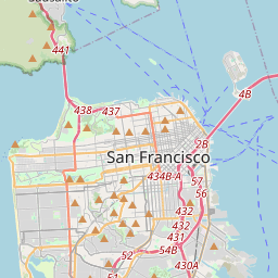
San Francisco auf der Karte

Datenquellen & Methodik

Unsere Wettervorhersagen werden von einem professionellen Wetterdatenanbieter bereitgestellt, der Daten von nationalen Wetterdiensten, Satellitenbeobachtungen, Radarnetzwerken und über 80.000 Wetterstationen weltweit zusammenführt. Die Vorhersagedaten werden mehrmals täglich aktualisiert. Wir wandeln Rohdaten in übersichtliche Zusammenfassungen um – Windgeschwindigkeit in m/s, Luftdruck in mmHg – damit Sie Ihren Tag mit Zuversicht planen können.